Check the site before you fly
Every UK drone flight starts with the same unglamorous question: can I legally and safely fly from here, today?
Answering it properly is more work than it should be. You check the airspace. You check for a Flight Restriction Zone around the nearest aerodrome. You look for danger, restricted and prohibited areas. You check NOTAMs in case something has changed since yesterday. You weigh up the category you are flying in and what that allows. For a one-off recreational flight that is a few minutes of admin. For a team running regular operations, or planning a fixed drone-in-a-box site, it is the same checks again and again, usually spread across several tabs.
We wanted that first read to be faster and clearer. So we built the Drone Regulations and Site Risk Tool, and it is now live in beta.
What it does
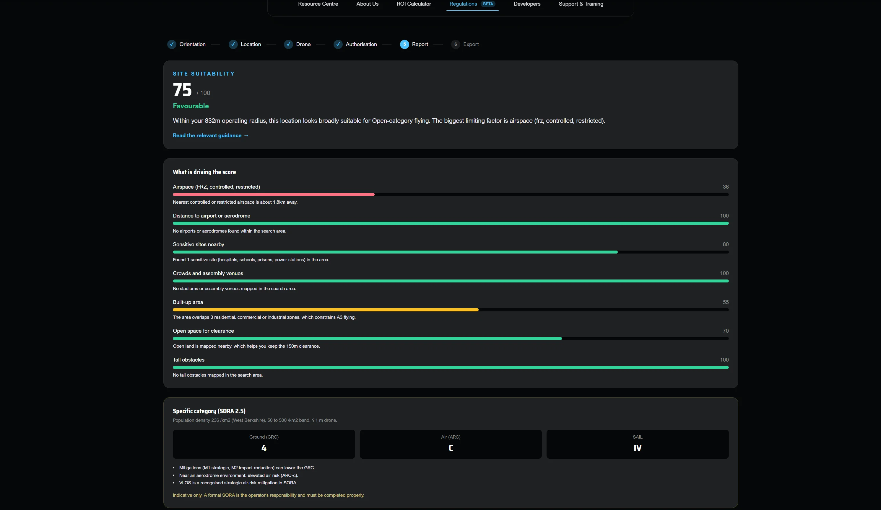
Drop a pin, set your operating radius, and you get an instant, explainable read on how suitable that site is for UK Open-category flying. Not a yes or no with no reasoning behind it, but a plain-English explanation of what is around you and why it matters. Alongside the map sits a guide to the rules that actually apply, written in normal language and linked back to the primary CAA sources so you can verify anything yourself.
One thing to be clear about up front: this is guidance to help you plan. It is never a substitute for CAA approval or your own pre-flight responsibility as the operator.
NOTAMs and airspace
The tool flags controlled airspace, aerodrome traffic zones, danger, restricted and prohibited areas, and Flight Restriction Zones on the map around your pin. It surfaces NOTAMs so you are not planning against a picture that changed overnight. The point is to put the things that stop a flight in front of you early, before you have driven to site.
Drone-in-a-Box site assessment
If you are placing a fixed dock rather than flying ad hoc, the questions are different and the stakes are higher. A dock site has to keep working week after week. The drone-in-a-box assessment looks at a fixed location the way a permanent operation needs to, so you can judge a site before you commit hardware to it.
Pilot operations planning
For anything beyond Open category, the tool includes a Specific mode built around SORA. Enter your aircraft details and operating intent and you get an indicative ground risk class, air risk class and SAIL, so you can see roughly where an operation sits before you start writing it up. Again, indicative and for planning. The formal assessment and authorisation still sit with you and the CAA.
It keeps up with the rules
Regulations and local restrictions move. The tool surfaces recent activity and regulations news alongside the guide, so the picture you are planning against reflects what is true now rather than what was true when you last read up.
We want beta users
This is where you come in. The tool is in beta, which means it is genuinely useful today and also genuinely unfinished. We would rather hear that from real operators than guess.
If you fly in the UK, please use it on a site you actually know. Then tell us what is wrong, what is missing, and what would make it something you would open before every job. Awkward feedback is the useful kind.
Try it here: https://www.idroneinnovations.com/resources/regulations
Send feedback here: https://www.idroneinnovations.com/contact?type=regulations-feedback